

YOU MAY ALSO LIKE
Free


Free


Free
Free
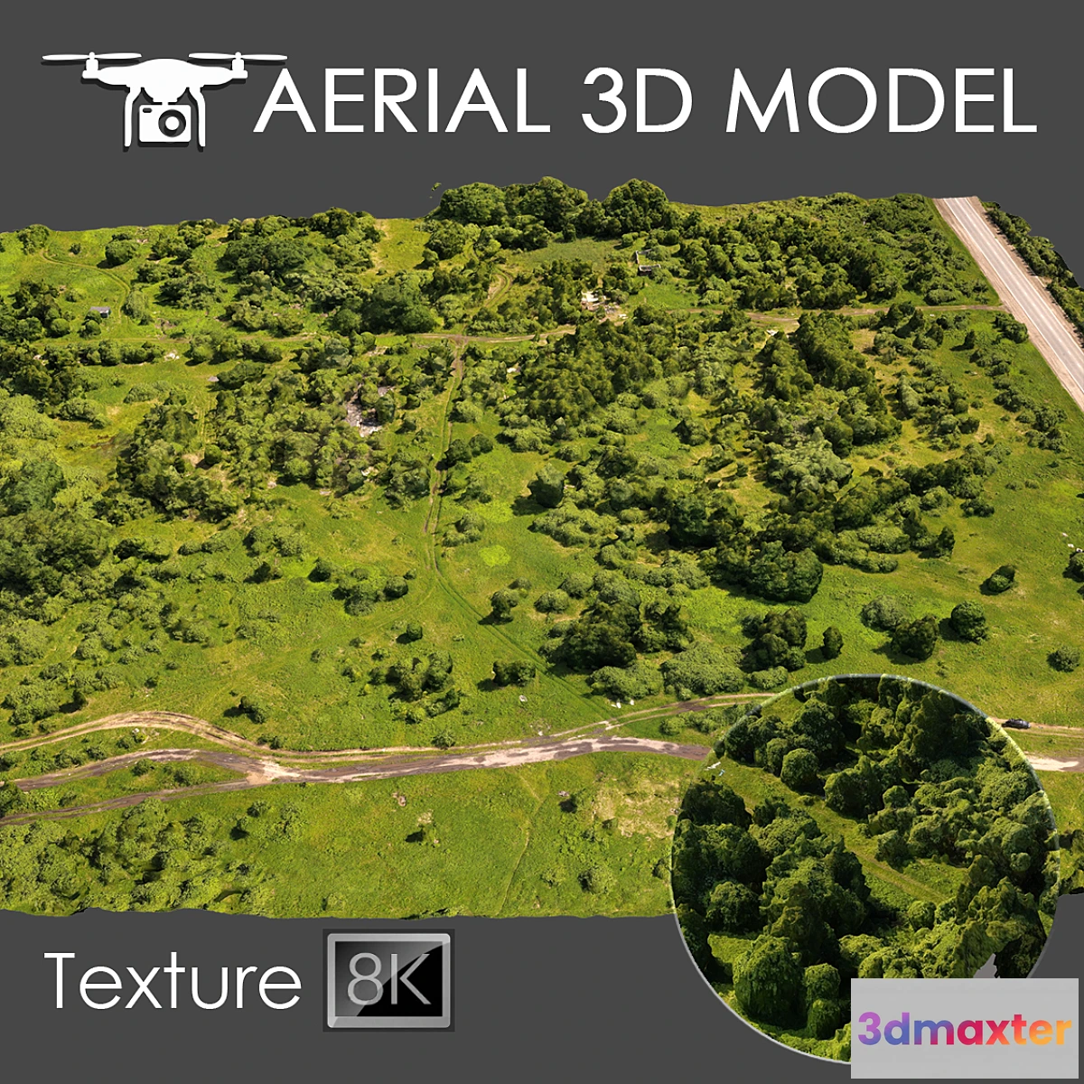
Terrain model made by quadrocopter
A 3D scan of the terrain was made using a quadrocopter at an altitude of 60 m.
The model consists of one Edit Poli with 1 texture scan.
Texture (scan) 8192×8192
Suitable for visualization of master plans as a background fill. The model is made on the basis of real photos and contains many details and features of the landscape.
I recommend editing the model with the Slice modifier so you can trim the model to the desired areas.
Use only for long-range plans as a preview.
Free
Please verify you are human to get the download link.

Reviews
There are no reviews yet.